In short
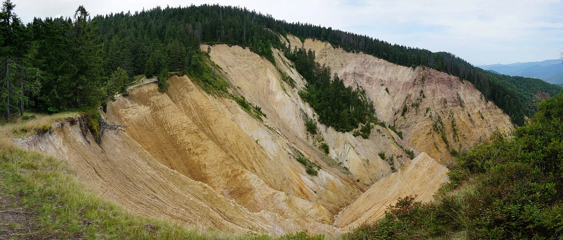
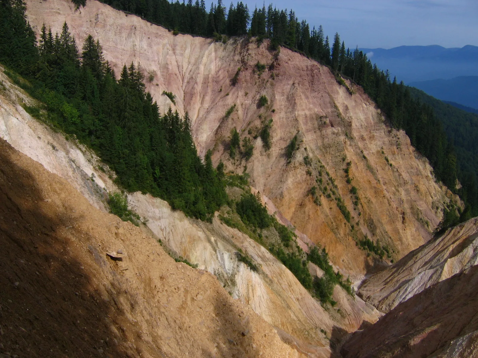
Groapa Ruginoasă ('the Rusty Pit') is an erosion gully over 600 m across and about 100 m deep on the border between Bihor and Alba counties, in Apuseni Natural Park. Its reddish colour comes from quartzite and red clay layers exposed by rain.
Distance from the hotel: 34 km as the crow flies
Key facts
- Sizeover 600 m across, about 100 m deep
- Whereterritory of the town of Nucet (Bihor), on the border with Alba, near the DN75
- Accesson foot, from the Arieșeni – Vârtop road; marked trails
- Protected areaGroapa Ruginoasă – Valea Seacă, 20.4 ha, inside Apuseni Natural Park
- Seasonsummer–autumn; in winter only with winter experience
- Distance from the hotel34 km as the crow flies
- Coordinates46.52660, 22.65180
The road distance is longer; check the route in your navigation app.
Groapa Ruginoasă ("the Rusty Pit") is a huge erosion gully in the Bihor Mountains, over 600 m across and about 100 m deep, on the border between Bihor and Alba counties. Its reddish colour comes from layers of quartzite and red clay that the rain washes out year after year. You reach it on foot, on marked trails starting from the Arieșeni – Vârtop road.
What Groapa Ruginoasă is
The gully was formed by active erosion, which ate into the slope almost up to the ridge closing the Valea Seacă valley to the south. Alba24 describes the reddish-violet quartzite layers that make the gully visible from afar. A post on Ștefan Cujmă's blog estimates the eroded area at about 20 ha and the material removed at around 7 million m³. Every rain adds a little to that figure: Groapa Ruginoasă is not a frozen landscape but one that changes before your eyes.
The Groapa Ruginoasă – Valea Seacă area is a 20.4 ha protected site inside Apuseni Natural Park. The rim is unstable: do not approach the edge or climb down the eroded slopes.
Getting there
The gully lies on the territory of the town of Nucet, near the DN75 road through Arieșeni and the Vârtop Pass.
- By car to the trailhead: from Arieșeni drive about 9 km towards Vârtop. Alba24 describes a large "Groapa Ruginoasă" sign by the road and the trailhead at the first big bend after kilometre 28, where the road crosses a stream coming down from Țapu peak.
- On foot: follow the tourist waymarks (Alba24 mentions red stripe and yellow stripe). Ștefan Cujmă also describes a trail approved in 2017 that starts at the last hairpin bend before Vârtop, with blue cross and yellow stripe, linking Groapa Ruginoasă with Tătăroaia peak: 17 km return, about 8 hours with breaks.
Sources give no standard time for the gully alone; allow at least a few hours there and back and check the route on an up-to-date map.
From Remeți: Vârtop is on the other side of the Bihor Mountains. Via Stâna de Vale and Beiuș, OSRM gives about 110 km and roughly two and a half hours to the Arieșeni – Vârtop area. It is a full-day trip.
Trail tips
- Waymarks are faint in places or painted on stones; the forest has many logging tracks that can lead you astray.
- Note the point where you leave the forest near the ridge; on the way back the path is hard to find in the tall vegetation.
- Bring water, rain gear and an offline map.
When to go
Summer and early autumn, in dry weather. After rain the ground around the gully is soft and slippery.
With children
Only with children used to long hikes. Keep them well away from the rim.
What to combine
Scărișoara Ice Cave is also on the Alba side of the Bihor Mountains; with a night on the way you can link them comfortably. Padiș and Cetățile Ponorului connect to the Vârtop area via marked ridge trails.
Staying nearby
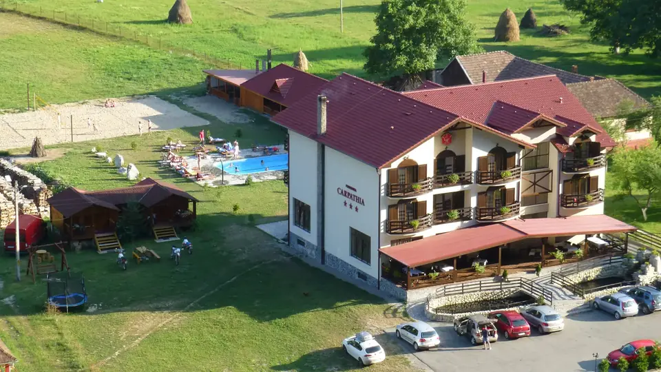
Hotel Carpathia Apuseni in Remeți is about two and a half hours from Vârtop, so it is not the right base if you only want to see Groapa Ruginoasă. If you are touring the Apuseni, Carpathia covers the northern part well: Iad Valley, Stâna de Vale, the Leșu and Drăgan lakes and the Pădurea Craiului caves.
Photos
On the map
Frequently asked questions
Where is Groapa Ruginoasă?
In the Bihor Mountains, on the territory of the town of Nucet (Bihor County), on the border with Alba County, near the DN75 road through Arieșeni and the Vârtop Pass.
How do you get to Groapa Ruginoasă?
From Arieșeni, drive about 9 km towards Vârtop. The trail starts at the first big bend after kilometre 28, where the road crosses a stream coming down from Țapu peak; follow the waymarks.
How big is Groapa Ruginoasă?
It is over 600 m across and around 100 m deep. The eroded area covers about 20 ha.
Why is Groapa Ruginoasă red?
Erosion has exposed reddish-violet quartzite and red clay layers. Every rain washes away more material, so the gully keeps growing.
Sources
- Groapa Ruginoasă, canionul spectaculos din Munții Apuseni — Alba24, 20.03.2022 (accessed 12 November 2026)
- Groapa Ruginoasă, Via Ferrata Vârtop — Ștefan Cujmă, 2019 (accessed 12 November 2026)
- Drumeție Vârtop – Groapa Ruginoasă – Vf. Tătăroaia — Ștefan Cujmă, 2021 (accessed 12 November 2026)
- Apuseni Natural Park — Wikipedia (accessed 12 November 2026)
- Groapa Ruginoasă — OpenStreetMap (Nominatim) (accessed 12 November 2026)